US Extreme Weather: Projections for the Next Decade
The latest projections for the increase in extreme weather events in the US over the next decade indicate a definitive rise in frequency, intensity, and duration, driven primarily by ongoing climate change, affecting regions differently but presenting significant nationwide challenges.
The question of what are the latest projections for the increase in extreme weather events in the US over the next decade is increasingly vital for communities, policymakers, and businesses across the nation. Understanding the evolving landscape of climate-related risks is no longer a theoretical exercise but a practical imperative.
Understanding the Baseline: Current Trends in US Extreme Weather
Before delving into future projections, it’s essential to grasp the current trajectory of extreme weather events reshaping the US landscape. Decades of observational data reveal a clear and accelerating trend, indicating that what was once considered anomalous is steadily becoming the new normal. This baseline understanding is crucial for appreciating the significance of future forecasts.
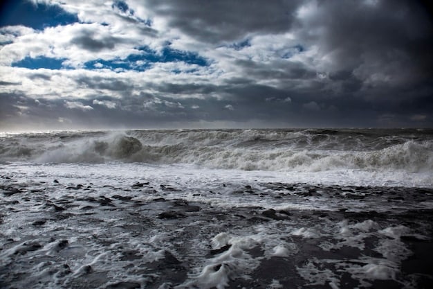
The past decade alone has witnessed an escalating number of billion-dollar disasters, encompassing a range of phenomena from devastating wildfires in the West to relentless heatwaves across the Plains and powerful hurricanes along the Atlantic and Gulf Coasts. This increase isn’t merely an aggregation of isolated incidents; it reflects a systemic shift driven by a changing climate.
Observed Increases in Specific Events
Scientists have meticulously documented the historical rise in particular types of extreme weather. For instance, the frequency and intensity of heatwaves have demonstrably increased, leading to higher risks of heat-related illnesses and infrastructure strain. Similarly, heavy precipitation events, which can cause significant flooding, are also becoming more common in many regions.
- Heatwaves: More frequent, longer duration, and higher intensity, especially in urban areas.
- Heavy Rainfall: Increased downpour events across the Midwest and Northeast, leading to flash floods.
- Coastal Flooding: Rising sea levels are making nuisance flooding more common and severe, particularly along the East Coast.
Furthermore, the western US has experienced a marked increase in the frequency and severity of large wildfires, a phenomenon exacerbated by prolonged droughts and warmer temperatures creating ideal conditions for ignition and rapid spread. These trends are not coincidental; they are interwoven with the broader narrative of a warming planet.
The scientific consensus firmly links these observed changes to anthropogenic climate change, primarily driven by the emission of greenhouse gases. Understanding this causal link is fundamental to interpreting the models that project future extreme weather. Without this foundational knowledge, future projections lack context and urgency.
The collective impact of these current trends is already substantial, leading to massive economic costs, displacement of communities, and significant loss of life. These historical observations provide a sobering backdrop against which future projections must be considered, highlighting the immediate and undeniable consequences of a changing climate.
Key Scientific Models Guiding Future Projections
Predicting the future of extreme weather events is a complex undertaking, relying heavily on sophisticated scientific models and robust data analysis. These models, developed by leading climate scientists and institutions worldwide, integrate vast amounts of information to simulate future climate scenarios, offering invaluable insights into potential changes over the next decade and beyond.
The primary tools for these projections are global climate models (GCMs) and regional climate models (RCMs). GCMs simulate the Earth’s climate system at a broad scale, capturing interactions between oceans, atmosphere, land, and ice. RCMs then downscale these projections to provide more localized and detailed insights, crucial for understanding impacts at a regional or state level within the US.
Role of Intergovernmental Panel on Climate Change (IPCC)
The IPCC reports serve as a foundational resource for climate projections. They synthesize the work of thousands of scientists, providing comprehensive assessments of climate change science, impacts, adaptation, and mitigation. Their emission scenarios, known as Shared Socioeconomic Pathways (SSPs), are critical inputs for these models, representing different possible futures of greenhouse gas emissions based on socioeconomic development and climate policy.
- SSP1-2.6: Focuses on sustainable development with low emissions.
- SSP2-4.5: Represents a ‘middle of the road’ scenario with moderate emissions.
- SSP5-8.5: Projects a fossil fuel-intensive development with very high emissions.
For the next decade, projections are less sensitive to the highest emission scenarios compared to long-term projections (e.g., by 2100), as climate system responses have inherent inertia. However, choosing different SSPs still influences the magnitude and certainty of expected changes, even over a short timeframe like ten years.
Beyond global models, national agencies like the National Oceanic and Atmospheric Administration (NOAA) and governmental research institutions (e.g., Argonne National Laboratory, National Center for Atmospheric Research) also contribute significantly. They often refine global models with US-specific data and regional nuances, improving the accuracy of projections for the nation.
These models incorporate various physical processes, including atmospheric circulation, ocean currents, cloud formation, and land-surface interactions. They are continuously refined as scientific understanding advances and computational power increases. Although uncertainties remain, particularly at very localized scales or for specific types of rare events, the overall trends projected by multiple models converge, reinforcing confidence in the general direction of future extreme weather.
The reliability of these models is constantly assessed through hindcasting—testing their ability to reproduce past climate conditions. This rigorous validation process ensures that the tools used to peer into the future are as accurate and robust as current scientific knowledge allows, providing a solid basis for understanding what lies ahead.
Projected Increases in Extreme Heat and Drought
Among the most consistent and concerning projections for the next decade in the US is the anticipated rise in extreme heat events and prolonged droughts. These two phenomena are intrinsically linked, often exacerbating each other, and their increasing frequency and intensity pose significant risks to human health, agriculture, water resources, and ecosystems across vast regions of the country.
Scientists project a noticeable increase in the number of days with temperatures exceeding historical averages, particularly in the Southwest, Southeast, and parts of the Midwest. This isn’t just about higher summer temperatures; it also includes warmer nights, which can prevent the body from recovering from daytime heat, leading to greater health risks.
Impact on Urban Heat Islands
Urban areas, already prone to the “urban heat island” effect, are expected to experience disproportionately higher temperatures. This is due to the prevalence of heat-absorbing materials like concrete and asphalt, minimal green spaces, and heat generated by human activities. The combination of global warming and this localized effect will lead to more frequent and intense urban heatwaves.
- Increased Heat Stress: Higher incidence of heat-related illnesses and mortality, especially among vulnerable populations.
- Energy Demand Spikes: Greater reliance on air conditioning, straining power grids and increasing energy costs.
- Infrastructure Damage: Heat can buckle roads, warp railway lines, and stress critical infrastructure.
Drought conditions are also projected to become more severe and widespread. The Southwest, already grappling with a megadrought, is expected to see a continuation and potential deepening of arid conditions. However, other regions, including parts of the Plains and even the Southeast, could experience more frequent and prolonged periods of water scarcity.
The implications for agriculture are profound. Reduced water availability, coupled with higher temperatures, can significantly reduce crop yields and livestock productivity. This threatens food security and can lead to economic instability in agricultural communities. Water management strategies will become even more critical, potentially leading to increased competition for scarce resources.
Furthermore, prolonged drought conditions contribute to increased wildfire risk, particularly in forested regions of the West. Drier vegetation acts as fuel, making fires easier to ignite and harder to control, leading to longer and more destructive wildfire seasons, as has been observed in recent years.
The nexus of extreme heat and drought also stresses natural ecosystems, impacting biodiversity and ecosystem services like water purification. As temperatures rise and water becomes scarcer, plant and animal species may struggle to adapt, leading to ecological disruptions that can have cascading effects throughout the environment.
Projections for Increased Precipitation and Flooding
While some regions face increased drought, other parts of the US are projected to experience a significant increase in heavy precipitation events and associated flooding over the next decade. This seemingly contradictory trend highlights the complex and varied ways climate change manifests across different geographical areas, often intensifying the water cycle wherever it occurs.
A warmer atmosphere holds more moisture—approximately 7% more for every 1°C increase in temperature. This enhanced moisture-holding capacity means that when precipitation does occur, it’s often delivered in more intense bursts, leading to a higher risk of flash floods, urban flooding, and riverine flooding. The Midwest and Northeast are particularly vulnerable to these changes, with already observed increases in heavy downpours.
Coastal and Inland Flooding Risks
Coastal regions face a double threat: increased heavy rainfall combined with rising sea levels. This combination amplifies the risk of nuisance flooding (often referred to as “sunny day” flooding) and storm surge during extreme weather events. Cities like Miami, New Orleans, and Norfolk are already grappling with these challenges, and projections indicate continued exacerbation over the next ten years.
- Urban Drainage Strain: Existing storm drains and infrastructure may be overwhelmed by increased rainfall intensity.
- Agricultural Losses: Flooding can devastate crops, erode soil, and saturate fields, impacting farming heavily.
- Infrastructure Damage: Roads, bridges, and essential services are vulnerable to prolonged or severe inundation.
Inland river basins are also at heightened risk. More frequent intense rainfall events can lead to rapid rises in river levels, increasing the likelihood of major river floods. This has broad implications for communities situated along major waterways, potentially leading to more frequent evacuations, property damage, and disruptions to transportation and commerce.
The increased frequency of heavy precipitation events also brings challenges related to water quality. Runoff from flooded areas can carry pollutants into water bodies, impacting drinking water sources and aquatic ecosystems. Wastewater treatment plants can be overwhelmed, leading to sewage overflows and contamination.
While the overall annual precipitation might not drastically change in all areas, the *timing* and *intensity* of rainfall are shifting. This means longer dry spells interspersed with sudden, powerful deluges, creating a difficult environment for water management, agricultural planning, and infrastructure development. Communities will need to adapt their strategies for managing both water scarcity and abundance.
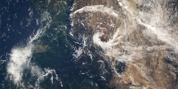
Projected Shifts in Storm Patterns: Hurricanes and Severe Storms
The behavior of tropical cyclones (hurricanes) and severe thunderstorms is also projected to shift significantly over the next decade, presenting different but equally formidable challenges for various regions across the US. While the exact number of storms is more uncertain, climate models consistently suggest changes in their intensity, speed, and precipitation characteristics.
For hurricanes, projections indicate that while the overall frequency might not change dramatically, the proportion of storms reaching Category 4 or 5 intensity is likely to increase. Warmer ocean waters provide more energy for these systems to develop and strengthen rapidly. This means fewer, but more powerful, storms could make landfall, leading to more catastrophic damage.
Slower Moving and Wetter Storms
Another critical projection for hurricanes is the potential for slower forward speeds. When a hurricane moves slowly, it lingers over an area for an extended period, delivering prolonged torrential rainfall and increasing the risk of widespread inland flooding, even far from the coast. Hurricane Harvey (2017) and Florence (2018) highlighted this very destructive phenomenon.
- Increased Rainfall: Hurricanes are projected to carry more moisture, leading to higher precipitation totals.
- Rapid Intensification: Faster development of storm strength, giving less warning time for coastal communities.
- Shifts in Track: Potential northward shifts in general hurricane tracks, impacting areas previously less accustomed to direct hurricane hits.
Regarding severe thunderstorms, the dynamics are equally complex. While attributing individual events to climate change is challenging, scientific assessments suggest conditions conducive to severe weather, such as stronger updrafts and increased atmospheric instability, are likely to become more common in certain regions, particularly across the central and eastern US.
This includes potential shifts in the frequency and intensity of hail, damaging winds, and tornadoes. While the science on climate change’s direct influence on tornado frequency is still evolving, the underlying atmospheric conditions that foster these storms are influenced by warming temperatures. Earlier springs, for instance, could extend the severe thunderstorm season.
The implications of these projected shifts are profound. Coastal communities, still recovering from previous hurricane seasons, face the prospect of more destructive storms. Inland regions face enhanced risks from flash flooding, river flooding, and powerful wind events associated with severe thunderstorms, necessitating updated hazard mitigation plans and enhanced early warning systems.
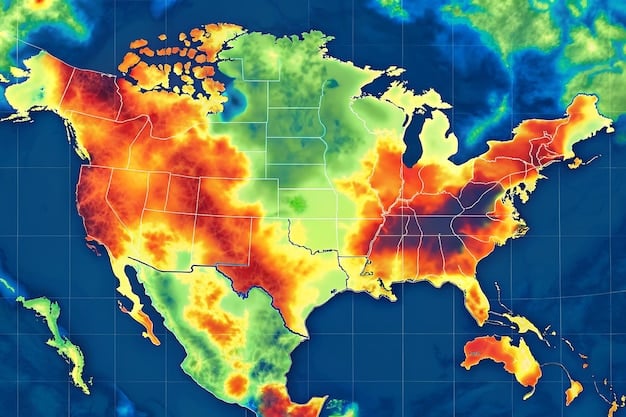
Regional Variations in Projected Extreme Weather Impacts
The US is a vast and climatically diverse nation, meaning the projected increases in extreme weather events will not manifest uniformly across all regions. While global warming is a nationwide phenomenon, its local expressions vary, leading to distinct challenges and impacts unique to different geographical areas over the next decade.
The Southwest, for example, is consistently projected to face the most severe increases in extreme heat and prolonged drought. This region’s arid climate, coupled with rising temperatures and changes in snowpack melt, means ongoing water scarcity issues are likely to intensify, affecting major reservoirs like Lake Mead and Lake Powell, and impacting urban water supplies and agriculture.
East Coast and Gulf Coast Vulnerabilities
The East Coast and Gulf Coast are particularly vulnerable to coastal flooding exacerbated by sea level rise and an increased intensity of tropical cyclones. As the Atlantic warms, the potential for more powerful hurricanes means greater risks of storm surge, heavy rainfall, and wind damage, posing existential threats to low-lying coastal communities and infrastructure.
- Southwest: Increased heatwaves, severe and prolonged droughts, elevated wildfire risk.
- Midwest: More frequent heavy rainfall events, increased flooding, potential shifts in severe thunderstorm patterns.
- Northeast: Significant increases in heavy precipitation, higher winter temperatures, potential for enhanced coastal flooding.
The Pacific Northwest, while often associated with rain, is also expected to experience more extreme heat events, particularly during summers, which can lead to increased wildfire risk in its forested areas and impacts on snowpack, a critical water source. Changes in the timing and volume of snowmelt could further strain water resources.
Conversely, parts of the Great Plains and Midwest are projected to see a notable increase in the frequency and intensity of heavy precipitation events, leading to greater risks of riverine and agricultural flooding. While overall annual precipitation might not change in some of these areas, the shift towards more intense downpours with longer dry spells in between presents distinct agricultural and water management challenges.
Alaska is projected to experience some of the most dramatic changes in temperature, leading to accelerated permafrost thaw, which impacts infrastructure and ecosystems. While not typically associated with classic “extreme weather” like hurricanes in the lower 48, the rapid warming creates its own set of extreme challenges for communities and wildlife.
These regional variations underscore the need for tailored adaptation and mitigation strategies. What works for a coastal city dealing with hurricane risk may be irrelevant for an inland agricultural community facing drought or river flooding. Understanding these localized projections is key to developing effective and resilient responses across the diverse US landscape.
Anticipated Socioeconomic Impacts and Adaptation Strategies
The projected increase in extreme weather events over the next decade in the US will inevitably usher in significant socioeconomic impacts, affecting everything from public health and infrastructure to economic stability and community resilience. Understanding these anticipated consequences is the first step towards developing robust adaptation and mitigation strategies.
Public health will face increased pressure from heat-related illnesses, vector-borne diseases (due to shifting climate zones), and respiratory issues exacerbated by wildfire smoke and poor air quality. Vulnerable populations, including the elderly, children, and low-income communities, are often disproportionately affected, highlighting equity considerations in adaptation planning.
Infrastructure Resilience and Economic Costs
Critical infrastructure, from transportation networks and energy grids to water systems and communication lines, faces unprecedented stress. Roads can buckle from heat, power lines succumb to severe storms, and water pipes burst from extreme cold or are overwhelmed by floods. The costs of repairing and rebuilding this infrastructure will be substantial, draining public and private resources.
- Economic Disruption: Supply chain interruptions, agricultural losses, and reduced tourism from extreme events.
- Increased Insurance Premiums: Rising costs for property and flood insurance, making coverage unaffordable for some.
- Displacement and Migration: Communities may face forced relocation due to uninhabitable conditions or repeated damages.
The agricultural sector will continue to grapple with unpredictable weather patterns, including droughts, floods, and altered growing seasons. This instability threatens farm livelihoods and national food security, necessitating investments in climate-resilient farming practices and diversified crop portfolios.
In response to these challenges, a range of adaptation strategies is being developed and implemented. These include “hardening” infrastructure—making it more resistant to extreme weather—such as elevating structures in flood zones, reinforcing power grids, and developing drought-resistant water supplies. Nature-based solutions, like restoring wetlands to absorb floodwaters or planting urban forests to combat heat islands, are also gaining traction.
Furthermore, early warning systems for severe weather are continually being improved to provide more lead time for communities to prepare and evacuate. Policy frameworks are also evolving to incorporate climate resilience into urban planning, building codes, and disaster preparedness initiatives, fostering a more proactive rather than reactive approach to extreme events.
Ultimately, investing in adaptation now is far more cost-effective than repeatedly incurring the expenses of disaster recovery. These strategies aim not only to minimize damage but also to build more resilient communities capable of weathering the inevitable challenges posed by a changing climate over the coming decade.
| Key Projection | Brief Description |
|---|---|
| 🌡️ Extreme Heat | Increased frequency, intensity, and duration of heatwaves across most US regions, especially the Southwest. |
| 💧 Heavy Precipitation | More intense rainfall events, leading to increased flood risks in the Midwest and Northeast. |
| 🌀 Intense Hurricanes | While frequency may vary, a higher proportion of storms projected to reach Category 4/5 intensity. |
| 🔥 Wildfires/Drought | Continued and deepened drought conditions, particularly in the West, increasing wildfire severity. |
Frequently Asked Questions
▼
The primary driver is anthropogenic climate change, largely due to the emission of greenhouse gases from human activities. These emissions trap heat in the atmosphere, leading to a warmer planet that destabilizes weather patterns and intensifies extreme events. Scientists use sophisticated climate models to project these changes, emphasizing the direct link between rising global temperatures and more frequent and severe weather phenomena.
▼
No, the impacts will vary significantly by region. For example, the Southwest is projected to experience more extreme heat and severe drought, while the Midwest and Northeast are expected to see more intense heavy precipitation and flooding. Coastal areas will face increased coastal flooding due to sea level rise and stronger hurricanes. These regional differences necessitate localized adaptation strategies.
▼
Climate change is expected to increase the intensity of hurricanes, leading to a higher proportion of Category 4 or 5 storms. Warmer ocean temperatures provide more energy, enabling rapid intensification. Additionally, hurricanes are projected to carry more moisture, resulting in heavier rainfall, and potentially move slower, prolonging their destructive impact over land, increasing flood risks.
▼
Socioeconomic impacts include increased public health risks (heatstroke, respiratory issues), damage to critical infrastructure (roads, power grids, water systems), disruption of supply chains, agricultural losses, and rising insurance premiums. Vulnerable communities are often disproportionately affected, highlighting the need for equitable and comprehensive adaptation and resilience strategies across all sectors.
▼
Adaptation strategies include “hardening” infrastructure to withstand extreme weather, developing drought-resistant water supplies, improving early warning systems, and implementing nature-based solutions like wetland restoration. Long-term planning, updated building codes, and community-level disaster preparedness are crucial. These efforts aim to minimize damages, enhance resilience, and protect lives and livelihoods against future extreme weather events.
Conclusion
The latest projections paint a clear picture: the US is poised to experience a definitive increase in the frequency, intensity, and duration of extreme weather events over the next decade. From escalating heatwaves and prolonged droughts to more severe precipitation and potentially stronger, wetter hurricanes, the shifts are undeniable and will continue to challenge communities across the nation. Understanding these nuanced regional impacts and investing proactively in robust adaptation and mitigation strategies will be paramount as we navigate this evolving climate landscape, prioritizing resilience and preparedness for the challenges ahead.


